Pattison Ag Agronomy
Providing you with digital agronomic support for your operation!


VRAFY IS FULLY INTEGRATED WITH JOHN DEERE OPERATION CENTER™
Use satellite imagery or soil data to build your own variable rate prescriptions right in Operations Center™.
.png)
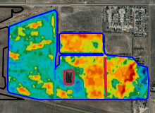
NDVI
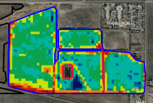
Rx MAP
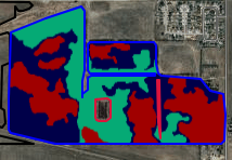
Soil Test Sites

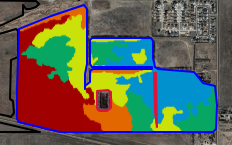
Soil CEC
PACKAGES:
SELECT
Package enables farmers to gain access to satellite imagery, integrate existing soil tests, create management zones, generate prescriptions, and run reports. Includes:- VRAFY software
- Ops Center integration
- Digital support from a Pattison Ag agronomist
PREMIUM
Package simplifies farm management by consolidating all of your essential data into one easy-to access location, saving you time and enhancing efficiency. Includes:- VRAFY software
- Ops Center integration
- Soil-sampling
- Digital support from a Pattison Ag agronomist
PARTNERSHIP
This package is designed for agri-businesses seeking a powerful software suite. Users can create management zones, develop sampling plans, and generate prescriptions to enhance the value provided to their clients. Includes:- VRAFY software
- Ops Center integration
- Digital support from a Pattison Ag agronomist

.png)